Waverley BC Borough Council, Godalming Lammas Lands overgone Meadow guide, on Bridge Street, Surrey, England, UK, GU7 3DU at sunset
Image details
Contributor:
Tony Smith / Alamy Stock PhotoImage ID:
2PG60WMFile size:
54.2 MB (1.9 MB Compressed download)Releases:
Model - no | Property - noDo I need a release?Dimensions:
5196 x 3648 px | 44 x 30.9 cm | 17.3 x 12.2 inches | 300dpiDate taken:
14 March 2023Location:
Bridge Street, Surrey, England, UK, GU7 3DUMore information:
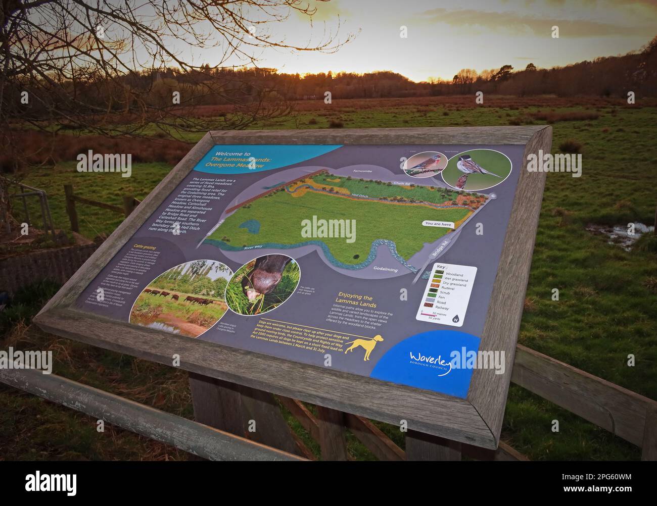
The Lammas Lands is an area of grassy floodplain meadows running alongside the River Wey in the centre of Godalming managed by the ranger service of Waverley Borough Council. The site is an important flood relief plain, open space and local amenity for the town of Godalming The history of the site as flood meadows goes back to Norman times although over the years the area has been reduced in size by adjoining development and is now about 32ha. The hydrology of the site was changed by the construction of Hell Ditch as a relief channel during the fifteenth century, the Wey navigation channel in the eighteenth century and the construction of the railway in the nineteenth century. The site is a locally designated Site of Nature Conservation Importance for its plant communities and grassland flora, including Meadow Saxifrage, Black Knapweed and Meadow Barley. It is also important for its wetland invertebrates and birds. Part of the area is also categorised as an Area of High Archaeological Potential and designated as an Area of Strategic Visual Importance by Waverley Borough Council and the whole area is registered common land with public rights of access. It is important that the meadows continue to be managed both as an uninterrupted flood plain and for its landscape, amenity and wildlife. The Council are producing a management plan for the site to guide management over the next ten years. Although not nationally designated the area has high local importance as a flood plain (reducing the risk of flooding to adjoining parts of the town) and for its biological and archaeological interest and landscape. It is also valuable amenity land, heavily used and much loved by the local community as an open space for walking, dog walking and nature study For all the above interests, it is important that the site be retained as open grassland, as without management, it would speedily revert to scrub and woodland. The most sustainable and traditional management is by grazing