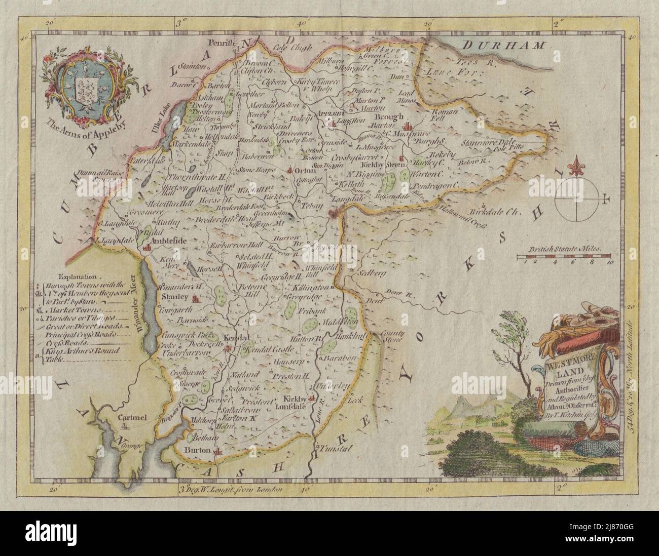
Westmoreland drawn from ye best Authorities. County map by Thomas Kitchin c1764
RFID:Image ID:2J870GG
Image details
Contributor:
Antiqua Print Gallery / Alamy Stock PhotoImage ID:
2J870GGFile size:
16.1 MB (987.1 KB Compressed download)Releases:
Model - no | Property - noDo I need a release?Dimensions:
2689 x 2087 px | 22.8 x 17.7 cm | 9 x 7 inches | 300dpiDate taken:
1764Location:
WestmorlandMore information:
This image could have imperfections as it’s either historical or reportage.
Westmoreland drawn from ye best Authorities and Regulated by Astronl. Observatns. By T. Kitchin Geog. Artist/engraver/cartographer: Thomas Kitchin. Provenance: "England Illustrated, or, A Compendium of the Natural History, Geography, Topography, and Antiquities Ecclesiastical and Civil, of England and Wales."; for R. and J. Dodsley, London. Type: Antique hand coloured copperplate map.