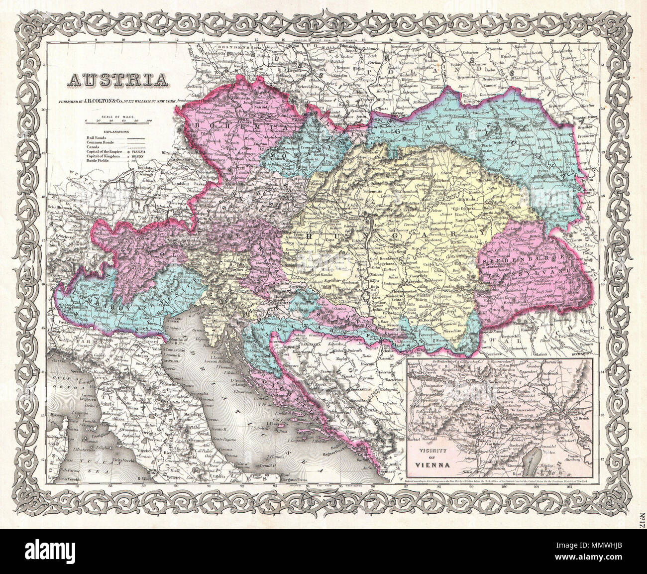
. English: This rare hand colored map of Austria is a copper plate engraving dating to 1856. Produced by the important mid 19th century American map publisher J. H. Colton. Covers the Austria, Croatia-Slavonia, Hungary, the Czech Republic (Bohemia), Romania, Transylvania, and parts of Italy including Lombardy and Venice. Prepared out of Colton's 172 William St, New York, office for inclusion as plate no. 17 in the single volume 1856 issue of Colton's Atlas of the World . Colton initially issued his atlas by subscription in two separate volumes, one for North America (issued in 1855) and one f
Image details
Contributor:
The Picture Art Collection / Alamy Stock PhotoImage ID:
MMWHJBFile size:
14.3 MB (1.9 MB Compressed download)Releases:
Model - no | Property - noDo I need a release?Dimensions:
2472 x 2022 px | 41.9 x 34.2 cm | 16.5 x 13.5 inches | 150dpiMore information:
This image is a public domain image, which means either that copyright has expired in the image or the copyright holder has waived their copyright. Alamy charges you a fee for access to the high resolution copy of the image.
This image could have imperfections as it’s either historical or reportage.
. English: This rare hand colored map of Austria is a copper plate engraving dating to 1856. Produced by the important mid 19th century American map publisher J. H. Colton. Covers the Austria, Croatia-Slavonia, Hungary, the Czech Republic (Bohemia), Romania, Transylvania, and parts of Italy including Lombardy and Venice. Prepared out of Colton's 172 William St, New York, office for inclusion as plate no. 17 in the single volume 1856 issue of Colton's Atlas of the World . Colton initially issued his atlas by subscription in two separate volumes, one for North America (issued in 1855) and one for the rest of the world (issued in 1856). This map however, is from the rarer late 1856 issue of the full atlas in a single volume – Colton’s first complete world atlas. Thus, though the copyright is 1855, we can be assured that this map comes from the 1856 issue of the Atlas . This map would later become the prototype of all subsequent Johnson maps of Russia. Dated and copyrighted, Entered according to Act of Congress in the Year 1855 by J. H. Colton & Co. in the Clerk's Office of the District Court of the United States for the Southern District of New York. Austria.. 1855 (dated). 1855 Colton Map of Austria, Hungary and the Czech Republic - Geographicus - Austria-colton-1855