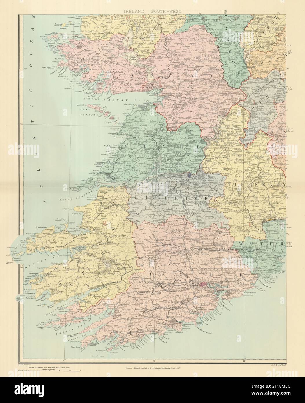
Ireland south-west Munster Kerry Limerick Cork Clare Limerick. STANFORD 1894 map
RFID:Image ID:2T18MEG
Image details
Contributor:
Antiqua Print Gallery / Alamy Stock PhotoImage ID:
2T18MEGFile size:
468.7 MB (24.9 MB Compressed download)Releases:
Model - no | Property - noDo I need a release?Dimensions:
11520 x 14220 px | 97.5 x 120.4 cm | 38.4 x 47.4 inches | 300dpiDate taken:
1894Location:
IrelandMore information:
This image could have imperfections as it’s either historical or reportage.
Ireland, South-west. Artist/engraver/cartographer: Stanford's Geographical Establishment. Provenance: "Stanford's London Atlas of Universal Geography", folio edition. London, Edward Stanford, Geographer to Her Majesty. 26 & 27 Cockspur Street, Charing Cross, S.W. Type: Large (folio) antique atlas map.